
Boating Apps: How do you Navigate the Mobile Minefield?
Boaters can load up their mobile devices with helpful applications.
CALIFORNIA ― As a boater, it is important to know the weather window. Checking the weather forecast is what boaters and sailors do prior to going out to sea. Having the best boating apps loaded onto your cellular phone or tablet is also a good plan.
In today’s world, so many resources are literally at boaters’ fingertips these days. With all the technology out there currently, boaters can access radio, internet sites and mobile applications.
Marine forecasts are available on NOAA’s National Weather Service website at weather.gov/marine. NOAA also has a national weather hazards listing all the radio frequencies at nws.noaa.gov/nwr. Both are great resources for mariners.
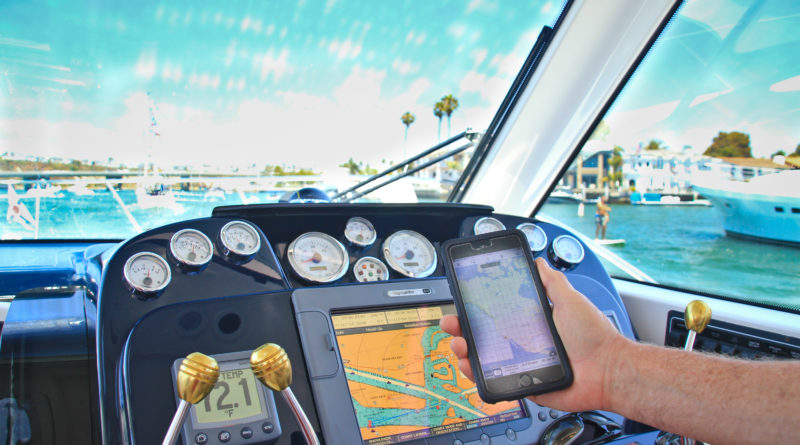
A mobile application – or app – can also be beneficial to boaters as a resource for weather, traffic and much more.
Numerous apps are obviously on the market; a few of them are sampled here to give you a perspective of what might be of interest before going out on the water. Some of the apps listed are free and some require a fee to purchase.
Weather and Wind
There are many ways to check the weather forecast, but weather can be unpredictable at times and suddenly change. Being alert for weather updates is always beneficial.
Navionics provides information on weather, tides, currents, nautical charts, port plans, marine services and more.
WINDY is an app for sailors and other water sport enthusiasts providing wind, wave and tide forecasts as well as a hurricane tracker. Wisuki and Boating Weather are a couple other weather apps with information on wind, waves and tides.
For those who want to be notified when the conditions are optimal, check out the app called Sailing Weather. This app allows you to indicate your ideal sailing conditions, and an icon pops up when the weather meets your conditions.
PredictWind may also be a helpful app providing wind forecast. The description on the app itself claims to be the top choice for sailors, and local sailor and sailboat owner Sage Marie agrees.
“My favorite wind app is PredictWind because it aggregates data from a few sources, and the wind mapping is super easy to read and understand,” Marie vouched.
As a backup to the chartplotter, Marie also uses the Garmin BlueChart app. This app wirelessly transfers weather data to your chartplotter.
Traffic
Just as roadways get congested with cars, waterways can also get clogged with vessels. Drivers have the app called Waze to help avoid traffic. Boaters have an app called MarineTraffic to assist with navigating congested waterways.
“I find the MarineTraffic app really helpful when visibility is poor or when there’s a lot of shipping traffic,” Marie stated. “I came up to [Los Angeles] from Newport in zero visibility and scanning between the radar, chart plotter, and MarineTraffic on my iPad gave us all the info we needed.”
Route Plan
Letting the people close to you know where you are planning to go in your vessel and your timeline of your departure, arrival and return is always a good plan. In case of an emergency, rescuers will have an easier time finding you, especially if you are alone.
Float Plan EZ! is an app to help you keep your loved ones informed of where you are, when you have arrived at your destination and when you have departed to head home.
Similar apps, such as BoatSafe Free and Skipper, also allow you to log your course as well as share your cruising or sailing route with others.
Another app called iNavX not only can log your route but also provides marine charts.
You can plan your route and save your favorite locations on Embark. This app also provides nautical charts as well as the ability to search for marinas, anchorages, fuel pumps and beaches.
Community
An app provided by American Sailing Association is Go Sailing. This app is similar to Facebook but for the sailing community. Create a profile and a sailing event to connect with friends and make new ones.
Sailing & Boating Community is another online community app for recreational boaters and sailors. The app also includes a classified section for those looking to buy a boat or looking to work as a crew member.
Races
For those who participate in sailing races, there is a countdown sailing watch app. Race Master Sail Timer will help you stay on track during your next regatta.
Another app for sailors is the tack X. This app tracks wind as well as sailing time and distance.
TracTrac provides GPS monitoring of all kinds of races, including sailing, so you can follow your favorite competitions.
Pumpout Stations
Wondering where a pumpout station is as you cruise in unfamiliar waterways? Check out the Pumpout Nav app to locate a station near you and to report any pumpout that may not be working properly. Even if you are not sure where you are exactly, the app will determine your location as long as you are along the California coast.
Log
Looking for a way to keep track of all your boating maintenance, fuel and expenses? Boating Suite is a complete boating log book to input and save all that information.
Boat Ramps
Boat Ramps is an app that provides the location and directions to marinas and boat ramps throughout the United States.
Many states including California also have a specific app to locate boat ramps. California Boat Ramps & Fishing Ramps provides locations and directions based on the city and zip code you enter as well as photographs and maps.
Additional Resources
Boater’s Pocket Reference is a guide encompassing all aspects of boating. The app covers information about navigation (using radar, sonar, charts and GPS), communication (using VHF, SSB and satellite), weather, rules of the road, time zones and conversion tables. This app also includes mechanical and electrical information as well as lines and knots.
If you want to learn more about knots, Knots 3D provides instructions on how to tie a quality knot.
The United States Coast Guard app provides a great deal of important information and resources. With this app, you can check a state’s boating laws, navigational rules and weather. With this app, you can also request a vessel safety check as well as report marine pollution or hazards. A float plan can be created with this app and shared with loved ones.
One Click Boating provides information on boating laws, services and safety. The app is also a resource for boat ramp locations. Boaters are also able to check weather and create a float plan with this app.
Another all-encompassing app about boating is The Practical Encyclopedia of Boating. The informative mobile guide provides information about boat handling, navigation, maintenance, design and more. This app is a resource for both powerboating and sailing.
Whether the boat is connected through WiFi, cellular or satellite to access the mobile applications, having basic navigation skills as a backup in case technology fails is always a good idea.
Please note, not all mariner applications have been included in this article, nor is The Log endorsing any of the apps listed. Many more apps are available especially those specific to a geographic location.
Nina K. Jussila photo
Why don’t you provide links to the apps in the article?
Thank you for your comment, Nik. The links are now live.
For a California waterway-specific boating app, the Division of Boating and Waterways supports a free “BoatCA” app that includes mapping of over 1400 boating facilities such as marinas and launch ramps, safety information, float plan email capability and links to emergency assistance, life jacket loan stations, events, boat registration, clean and green boating information, the DBW website, California boating laws, and new Boater Card information.